Park City Epic Trail Run 8-Mile
ANNOUNCEMENT: ALL COURSES ARE OPEN!
Race to the top of Jupiter Peak! This 8 mile epic lets you escape the crowds and take in the Park City beauty.
View Full Course Description
Course: The course is not marked. There is no support whatsoever along the way. See top of this page for GPX, Strava, Garmin download. You can use any fitness app that shows a map and elapsed time of your activity/route. Note that your fitness app might give slightly different mileages/elevation as stated above. That is common occurrence. Not a problem! Also note that different apps like trailforks may have different names for trails than what you see on the trail. The trailforks app has a great labeled map for this route. Click here. You can also use the trailforks app to record your Challenge.Make sure your fitness app device (phone) is a 100% charged.
Parking: park at the Empire pass parking lot (directions). This lot only has 15 spaces and fills up quickly. On weekends/holidays get get their early in the morning to ensure a space.You can also park down the road on Guardsman pass at the Bonanza Flat lot (directions) which is about 0.5 miles away from the Start/Finish
Start/Finish:
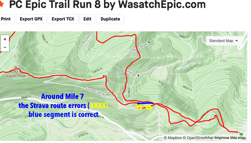
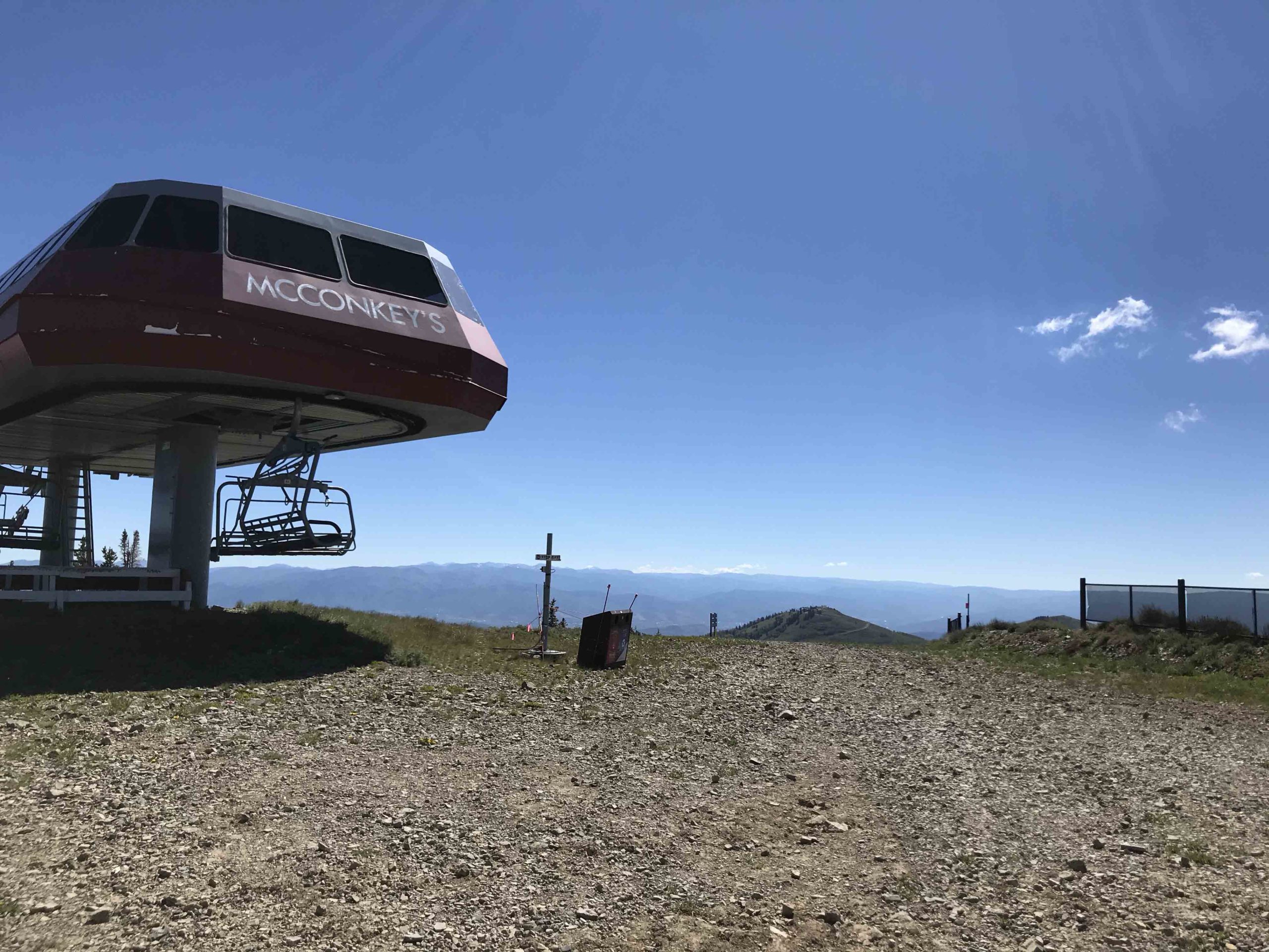
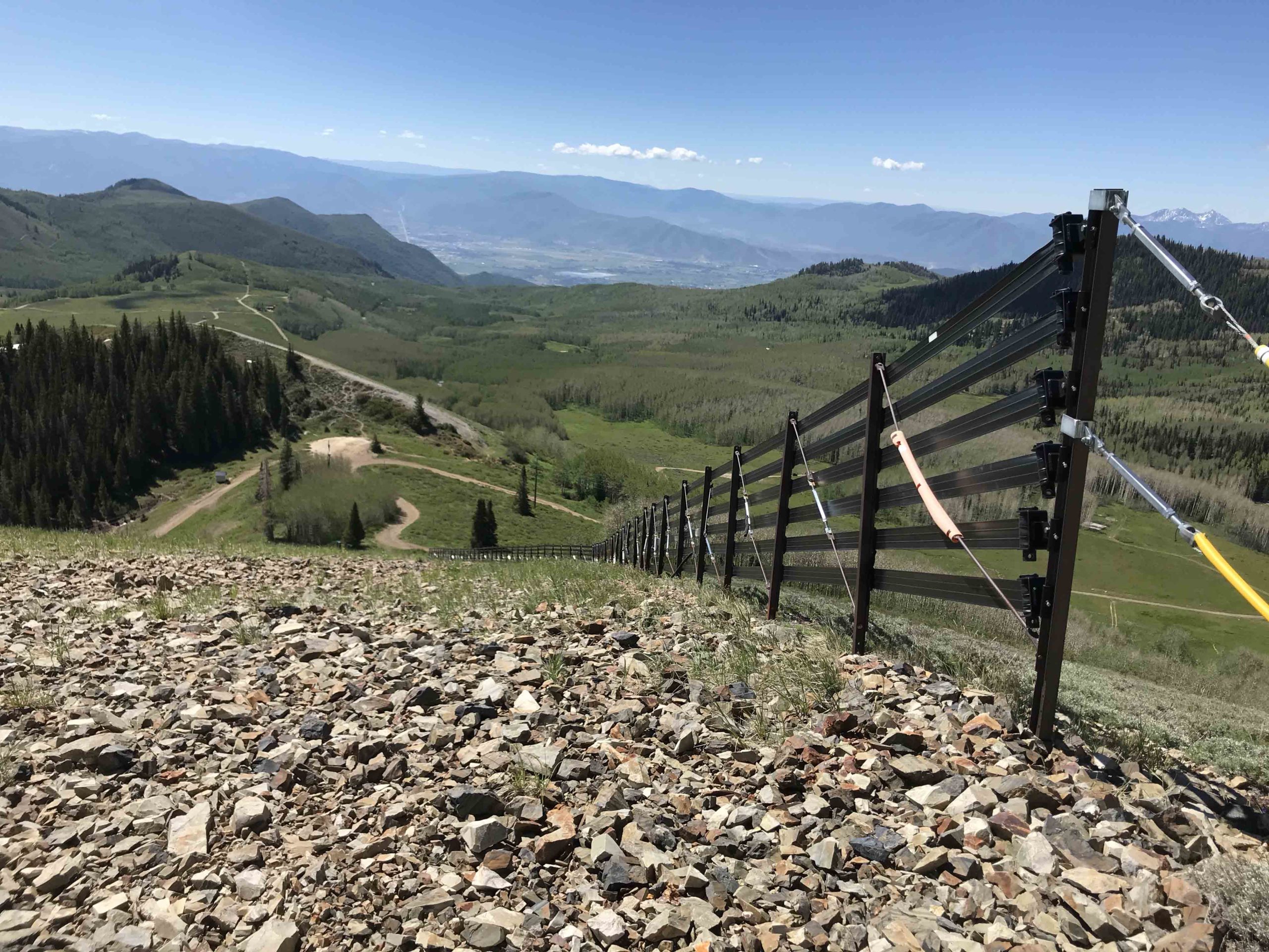
Start/Finish is at the gate in the Empire pass parking lot trailhead. Note: The first mile of the course criss crosses several times over the last mile of this course. Before you start, study the course gpx on the links above/your device to see the flow. Start by running down the wide path. Turn right on the 9K Trail. Right and down McConkey’s Trail (dirt road). Turn Left onto Fat Lip Trail (not signed). After awhile on the trail you’ll pop out onto a fork of the dirt road. At 11 o’clock the trail continues (Keystone Trail). Continue on Keystone Trail. In a little bit you’ll cross a dirt road and the trail splits (unsigned) stay straight (right fork). Stay on Keystone Trail as it wraps around the north side of the mountain. Turn left onto Apex trail following directions to Deadwood Trail. In about a mile cross the dirt road and continue onto Deadwood Trail. This is the Grunt part of the Challenge. Continue on up the trail enjoying the forest canopy and the sweeping views of Shadow lake. At the top, continue straight and turn left onto the double track. After a short grunt the road starts to wrap left around the rocky knoll. Exit the road and run straight up the knoll passing the wood pole (see photo gallery). As you crest the knoll the single track dumps onto the same road you just left. Continue on down the road. Look for and take the single track on the left just before the Ski Patrol shack. That Flagpole up on the left is Jupiter Peak. Take a victory lap around the pole then take a selfie so when you get back to the car you can post and tag @wasatchepicseries (facebook or Instagram) to be enrolled in the Giveways! You’ve reached the peak and now it’s pretty much all down from here. Take the steep single track that runs along next to the left side of the ski patrol shack and down the ridge to the east. Pass the top of McConkey’s Ski Lift and take the dirt road down. As you descend the road it will start to wrap down to the left. At this point you’ll see a berm on your right with a single track. Take this single track up and over to the top of Empire Express Ski Lift. Pass the top of the Empire Express ski lift house on your left and head right and you’ll see a big brown fence descending the slope. Descend this slope by following the fence all the way down. If you hug the side of the fence a single track will appear. The bottom of the slope dumps you onto a dirt road. At the bottom/fork in the road take the single track in the trees on the left about 10 o’clock (right to the left of the Daly Bowl/Daly Chutes sign) DO NOT take the single track that climbs the hill in front of you. The single track runs thru the forest a bit and then puts you into a clearing where it suddenly ends. (Note: while in the trees your strava may appear to send you hard right up and off the trail up into the trees. Don’t follow this. This is an error on Strava’s end. See last photo below in the gallery) Continue straight onto the double track down below. Continue straight onto the double track passing the 9k Trail on your left and a bit further down passing the 9K Trail on your right. Remain on the double track. In about ¼ mile you will again cross the 9k Trail remaining on the double track. A little bit further you’ll pass an unsigned single track on your left. Remain on the double track. As the double track peters out continue up the rise and hang a right on the dirt road passing thru the granite boulders that form a barrier. Continue down and turn right on the gravel path/road. Take this all the way back to the gate where you started. Stop your fitness app at the gate. Congrats! Jupiter Peak is in the Bag!
Safety/Warnings and Advice: You are on your own. The course is not marked.There is no support on the course whatsoever. Bring plenty of food and water. Practice proper trail etiquette. Make sure your fitness app/phone has the course downloaded and is fully charged so you don’t lose your way. Apps such as Strava can wear down your phone’s battery quickly make sure your battery will last several hours. Weather at this altitude can change quickly. Brief yourself on the weather. Do not go if there is chance of thunder and lightning.
-
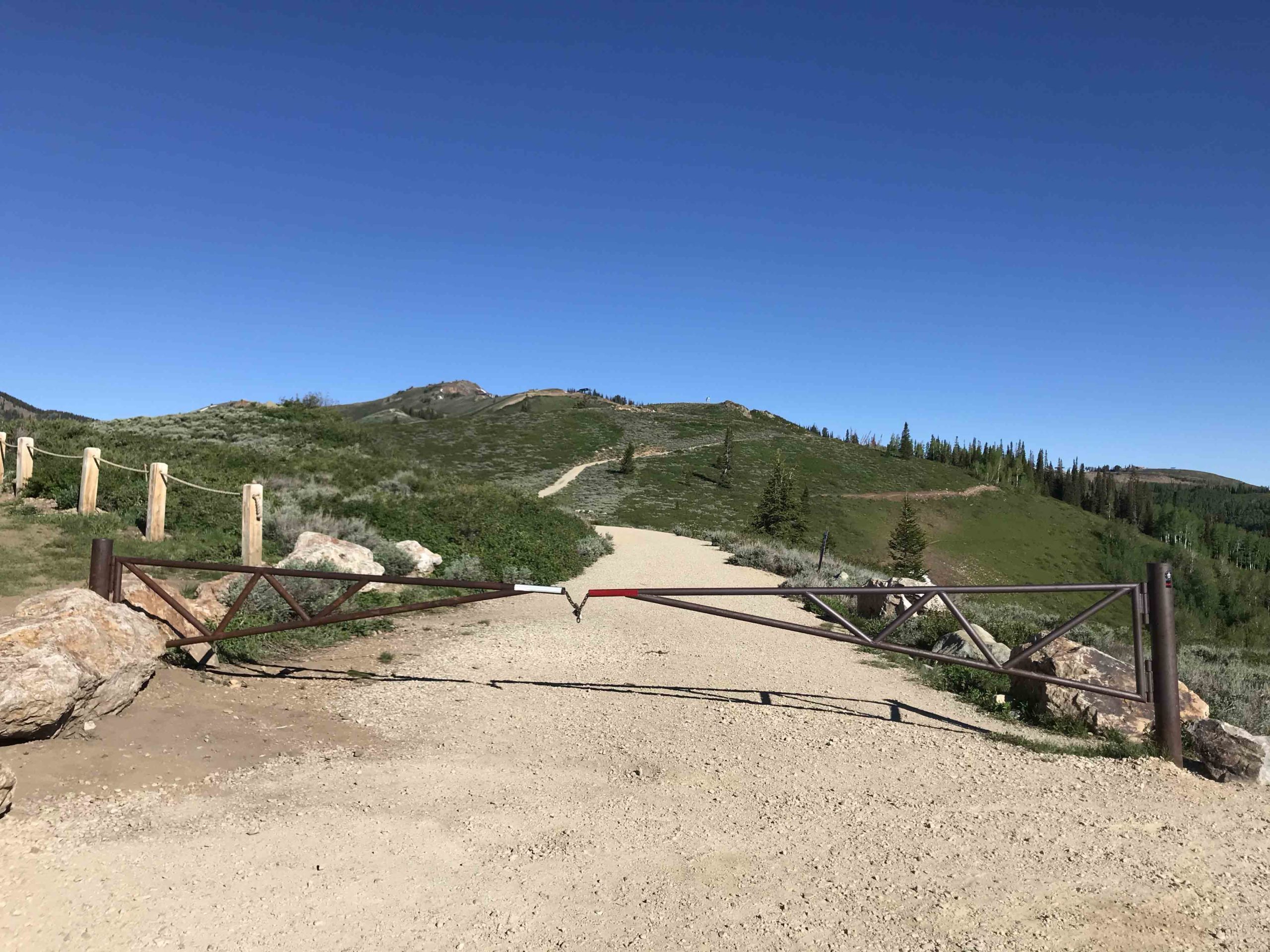
Start and Stop your fitness app next to this gate (Empire Pass parking Lot)
-
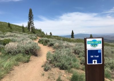
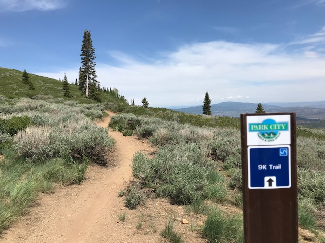
Turn Right onto 9K Trail
-
Hang a right on McConkey's Dirt Road and Barrel on Down the Road!
-
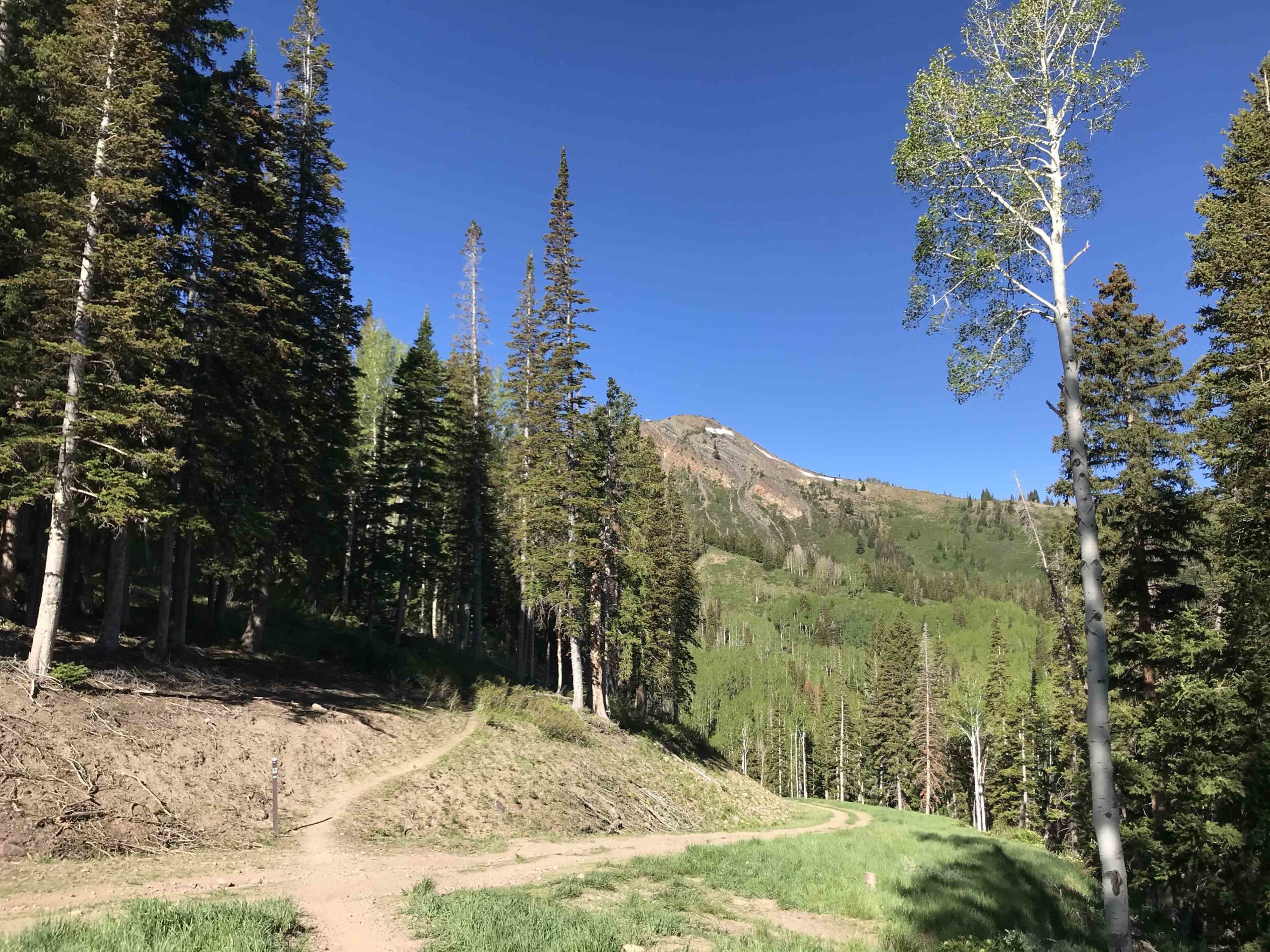
On the DeadTree Trail. Shadow Lake in background. Almost to Jupiter Peak!
-
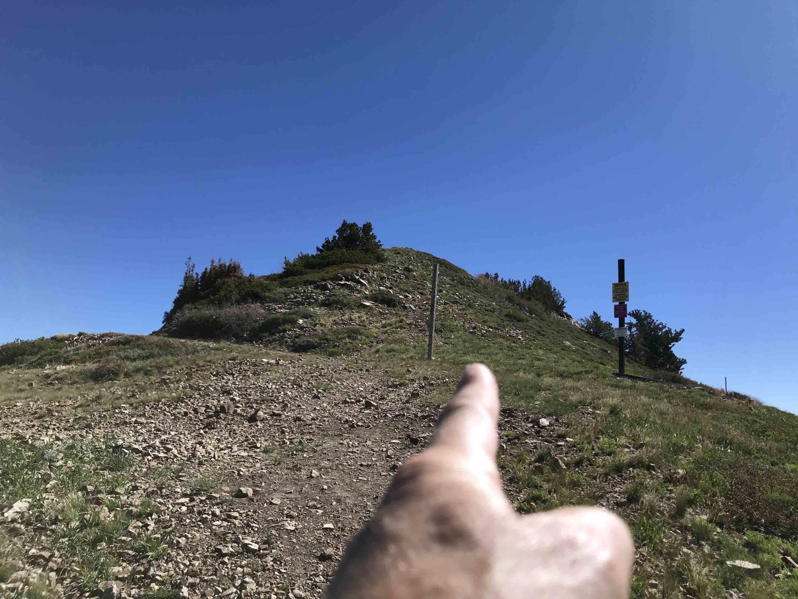
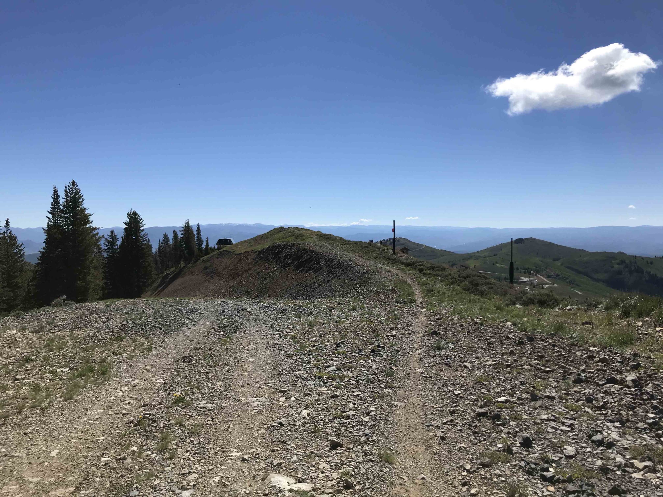
After reaching the top of DeadTreeTrail you turn left onto the double track. In a couple minutes continue straight up the hill on the faint single track next to the pole on the left
-
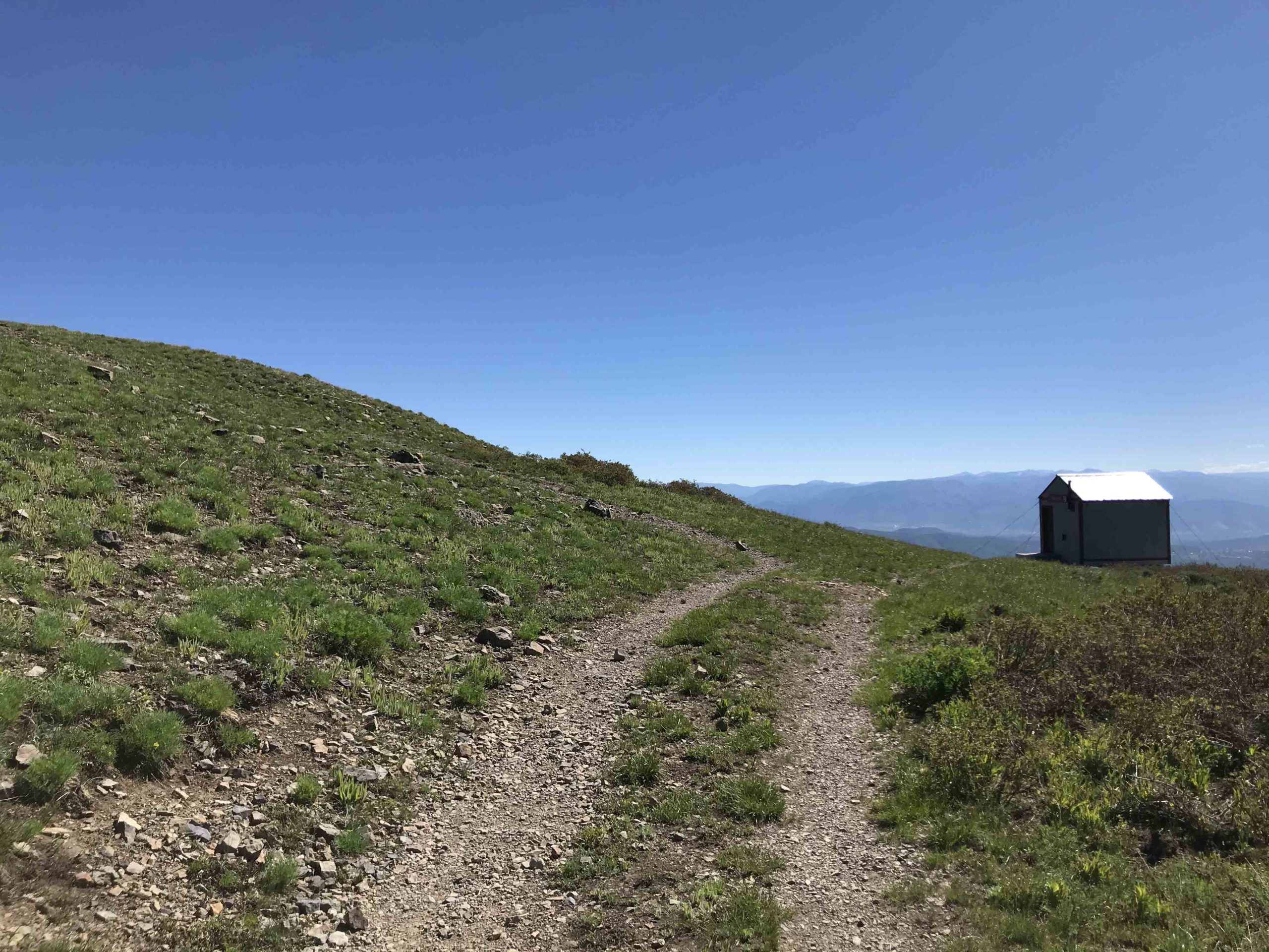
Almost to Jupiter Peak! Take the single track on the left before the shack
-
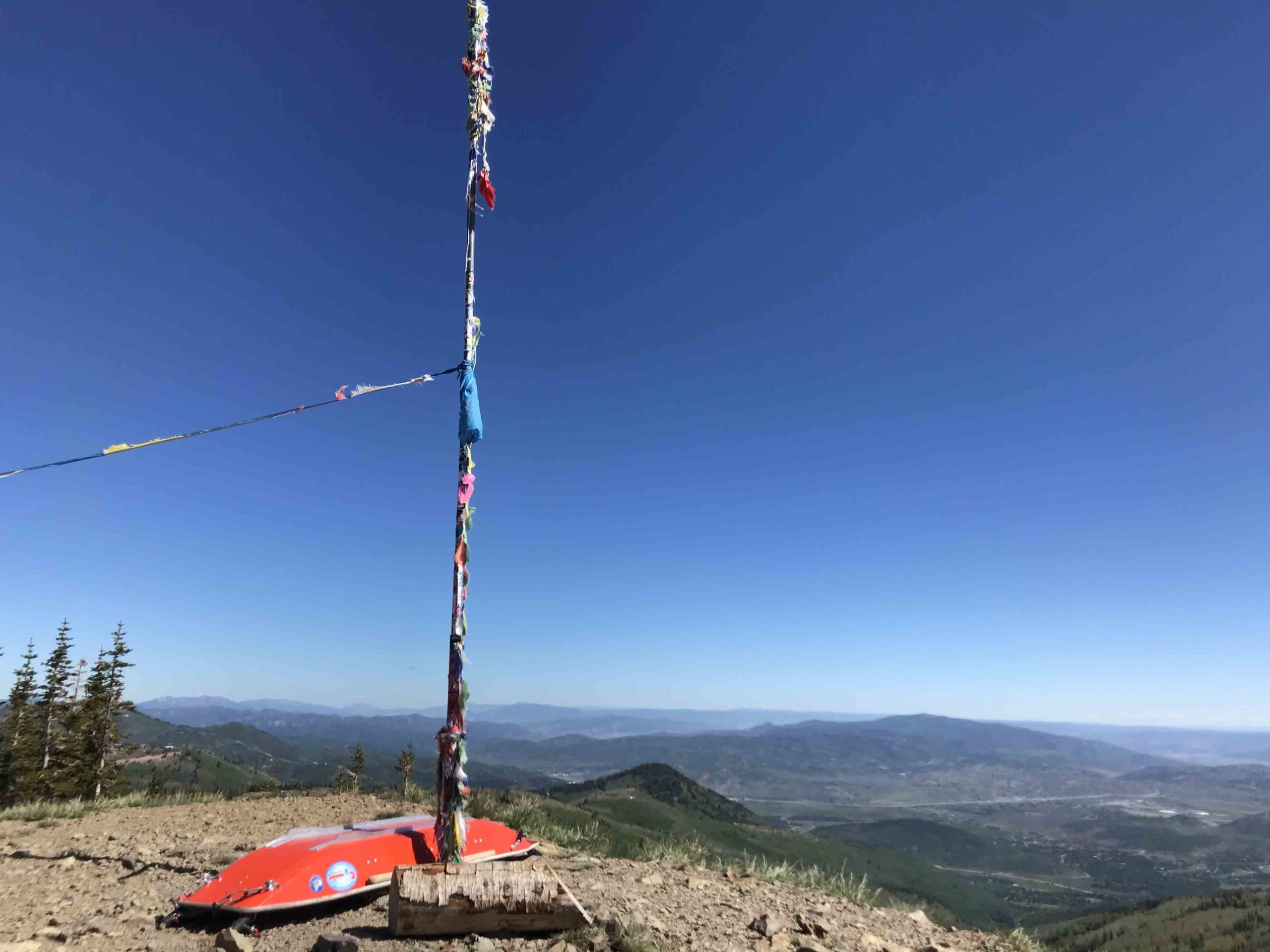
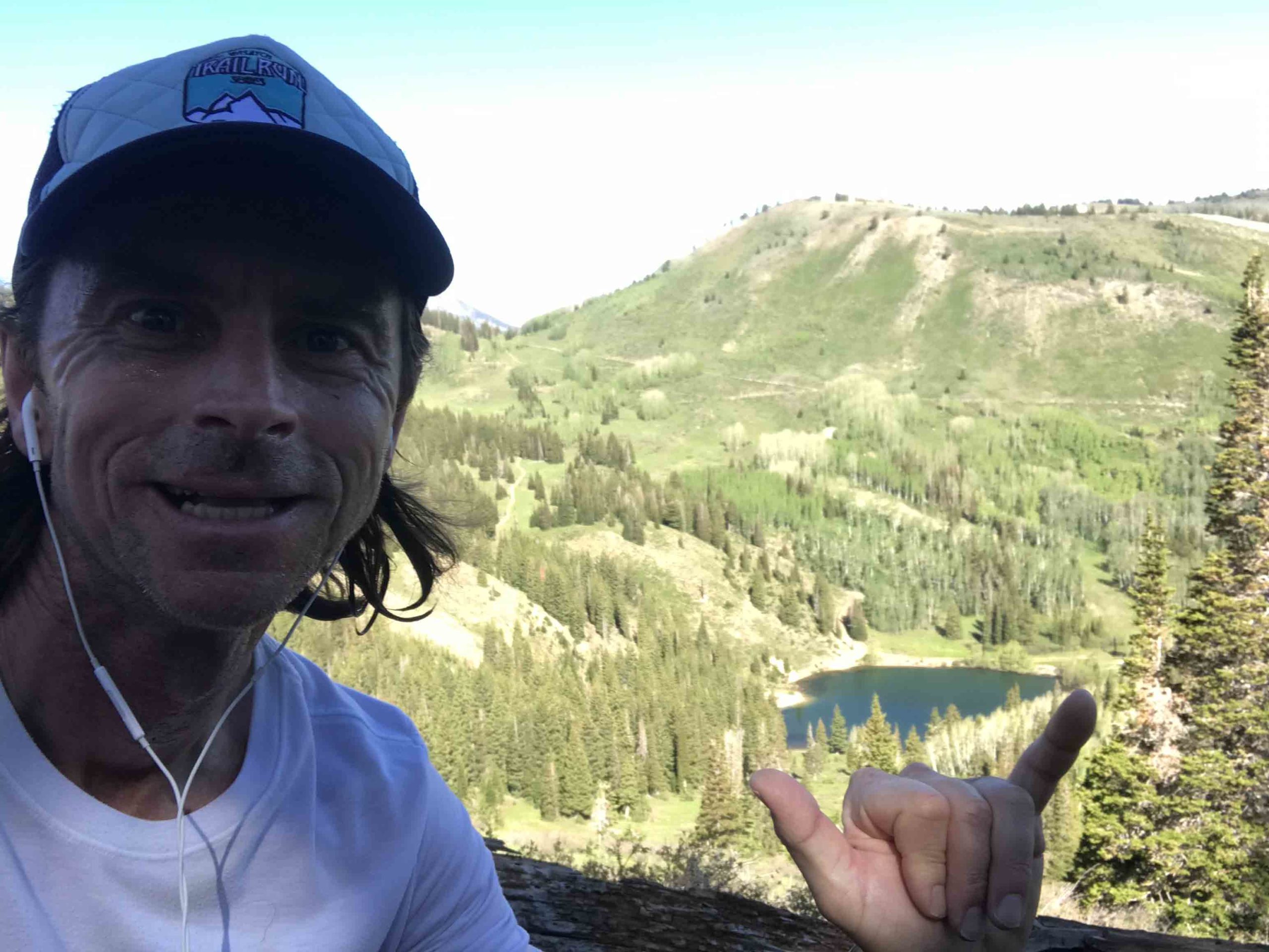
Jupiter Peak!
-
You Did It! Look how far you've come
-
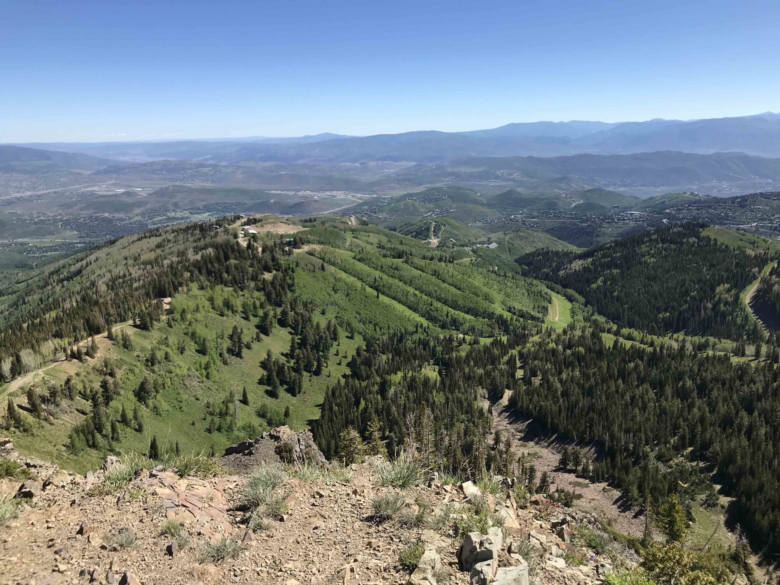
PC 8 Trail Run runs down the ridge
-
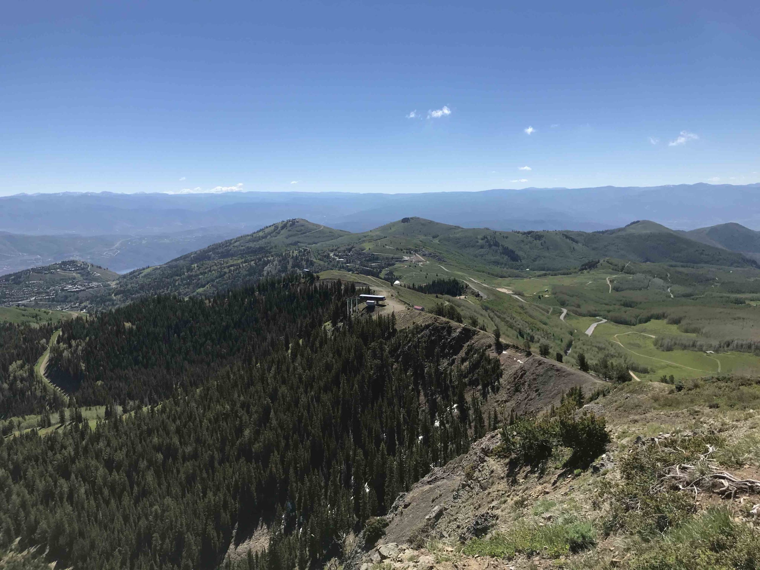
Keep on down the road past the top of McConkey's lift house
-
As you come down the road from the top of McConkey's lift take the single track on the right atop the berm
-
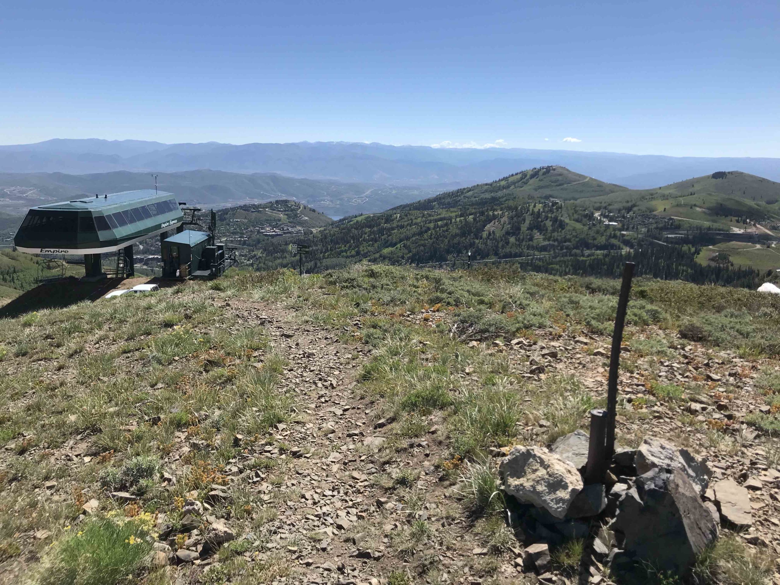
At the top of Empire Express Lift House continue right
-
Scramble on Down the Road!
-
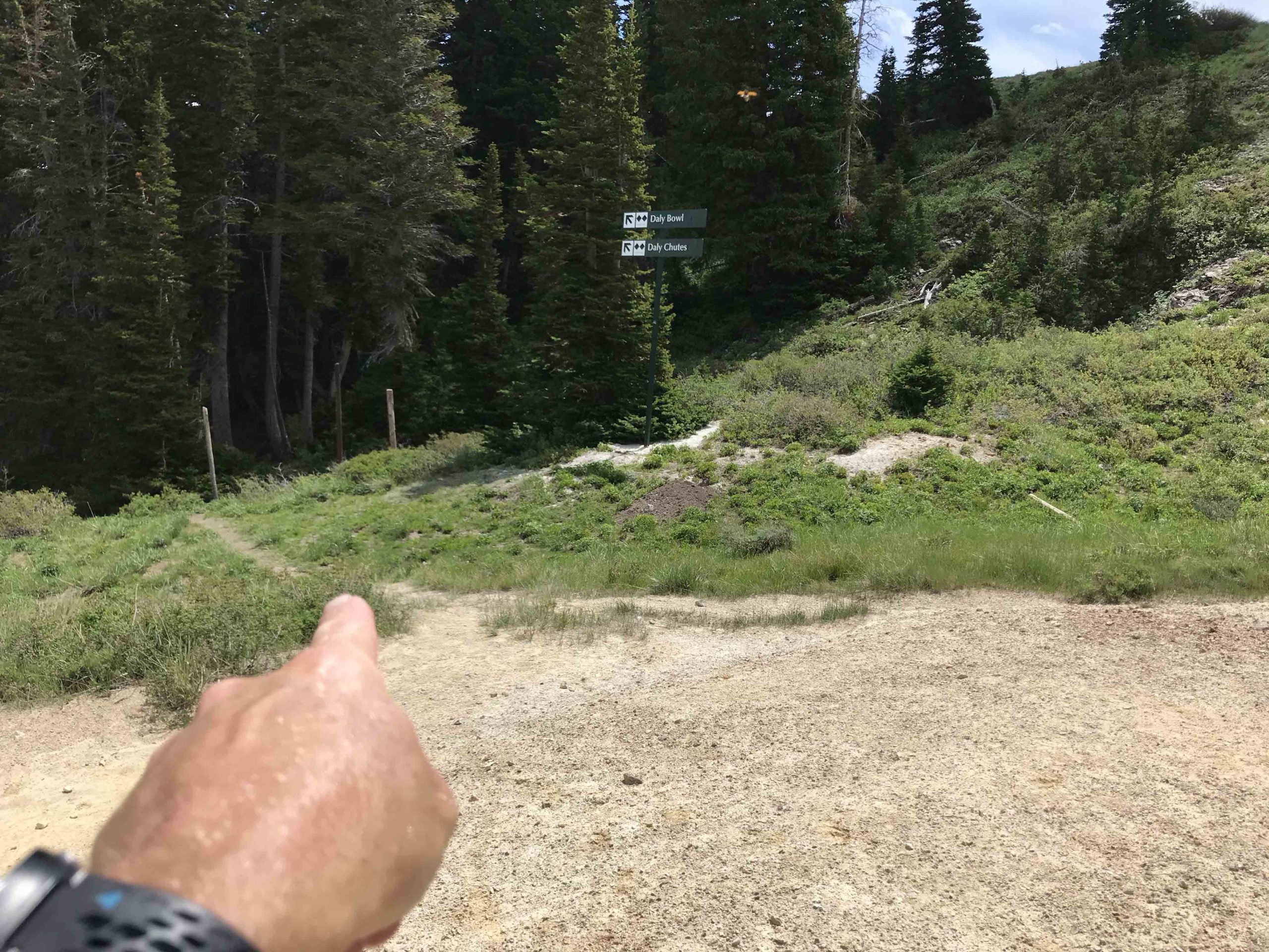
Take that single track on the left! Just over a mile to go! Once you are on that trail in the woods, see next photo regarding potential strava issue.
-
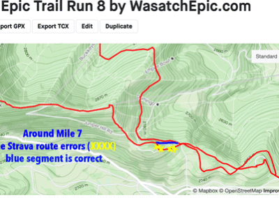
At mile 7 the Strava route shows an error. Continue on the trail you are on (blue color). This error is due to something on Strava's end. Sorry!